Source: Xinhua
10-24-2008 09:55
WASHINGTON, Oct. 19 (Xinhua) -- U.S. space agency NASA successfully launched a spacecraft at 1:48 p.m. EDT (1748 GMT) on Sunday to image and map the farthest reaches of the solar system, according to NASA website.
The IBEX (short for Interstellar Boundary Explorer) was launched aboard a Pegasus rocket, dropped from under the wing of an L-1011 aircraft flying over the Kwajalein Atoll, a part of the Marshall Islands in the Pacific Ocean.
 |
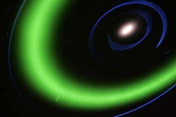
| A view of the earth's solar system is shown on a giant screen at the all-digital planetarium at the California Academy of Sciences building in Golden Gate Park in San Francisco, California September 18, 2008. The planetarium show allows audiences to visit the Moon, Mars and extra-solar planets before returning to take a close look at Earth.(Xinhua/Reuters Photo) |
At the drop time, the carrier aircraft was at an altitude of approximately 39,000 feet (11,900 meters) and traveling at a speed between 560 and 610 mph, NASA reported.
After successfully released, the Pegasus carried IBEX approximately 210 kms above Earth and placed it in orbit. "What makes the IBEX mission unique is that it has an extra kick during launch," said Willis Jenkins, IBEX program executive. An extra solid-state motor pushes the spacecraft further out of low-Earth orbit where the Pegasus launch vehicle leaves it.
"IBEX has separated from the third stage (of the rocket) and is flying on its own. All systems are operating as expected," NASA's real-time launch blog reported several minutes after the drop-launch.
The carrier aircraft has returned to Kwajalein safely as IBEX begins its two-year study of the outer edges of our solar system.
IBEX is shaped like a stop sign. It has eight sides and is 58 cms high and 96 cms wide. For power, the spacecraft uses solar cells that convert sunlight into electricity. IBEX's final orbit will take it up to 200,000 miles (320,000 kms) from Earth, which is almost 1,000 times higher than that of the International Space Station.
Six months into the mission, IBEX will have observed the entiresky, and will reveal the global structure of the boundary area for the first time.
Before IBEX, the two Voyagers satellites and Pioneer are the only spacecraft to have traveled to the edge of the solar system.
But IBEX is the first specially designed spacecraft to image and map the dynamic interactions taking place where the hot solar wind slams into the cold expanse of space. It will view the chaotic, but unseen, frontier of our solar system for the first time.
Known as the interstellar boundary, this region marks where the solar system meets interstellar space. "The interstellar boundary regions are critical because they shield us from the vast majority of dangerous galactic cosmic rays, which otherwise would penetrate into Earth's orbit and make human spaceflight much more dangerous," said David McComas, IBEX principal investigator.
The solar wind, a stream of charged particles spewing from the sun at 1.6 million kms per hour, carves out a protective bubble around the solar system. IBEX will help scientists confirm if this protective bubble is about to shrink and weaken.
Editor:Yang Jie
